Ice Storm Warning Tonight – Will “Instant Spring” Next Week Spark Significant Flooding?
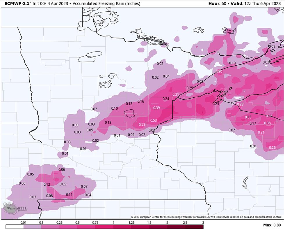
What a mess. At least we can handle snow, and most of us have figured out how to drive on snow. Glaze ice (freezing rain) is a different matter altogether. Nothing will give you traction and confidence on ice. Much of the Northland will pick up .1 to .3" of ice tonight, accompanied by wind gusts over 50 mph. The risk of downed trees and spotty power outages is significant, especially over the South Shore of Lake Superior and counties of northern Wisconsin.
Never tell a Minnesotan or Wisconsinite not to drive, but I would strongly suggest that, if possible, stay home tonight and don't tempt fate on the highways unless absolutely necessary. Here are more details on the ice storm potential from the Duluth National Weather Service:
If it's any consolation, ice is a symptom of spring and warming temperatures aloft, while temperatures at ground level are still stuck below freezing. A few thunderstorms may accompany the wind-whipped sheets of sleet (ice pellets) and freezing rain, rain freezing on contact with cold surfaces.
Check out the ECMWF (European model) wind forecasts for later today into Wednesday morning: sustained winds of 25-40 mph with gusts close to 60 mph!
On the backside of this storm temperatures aloft will start to cool down again late tonight and early Wednesday, with a period of (plowable) snow expected, possibly in the 4-8" range with more along the North Shore, as lake effect kicks in. Remember, all we need is 6.5" of snow to break the old all-time Twin Ports snowfall record of 135.4" set in 1995-96. At the very least tomorrow's snow should get us into the top 2 or top 3 winters. Lovely.

An amazingly rapid end to winter is shaping up across the Northland, with 50 degrees possible by Sunday, and a string of 50s next week - even an outside shot of 60F once we melt some snow. This will obviously result in rapid snowmelt, significant ponding of water on area highways and a growing potential for stream and river flooding in the very near future. If you've had problems with spring flooding in the past you may have issues over the next 1-3 weeks.
I am a meteorologist, not a hydrologist or river forecaster, but the Duluth office of the National Weather Service will be calling the shots and predicting the severity of flooding on area tributaries and we will be monitoring the situation closely.
I'm happy to see spring arriving next week, but what I feared most was a "light-switch", instant-on spring, which is exactly what is shaping up.
Be careful out there - milder days on the way and soon we can all exhale.
12 Reasons Not To Look Forward To Spring
More From MIX 108