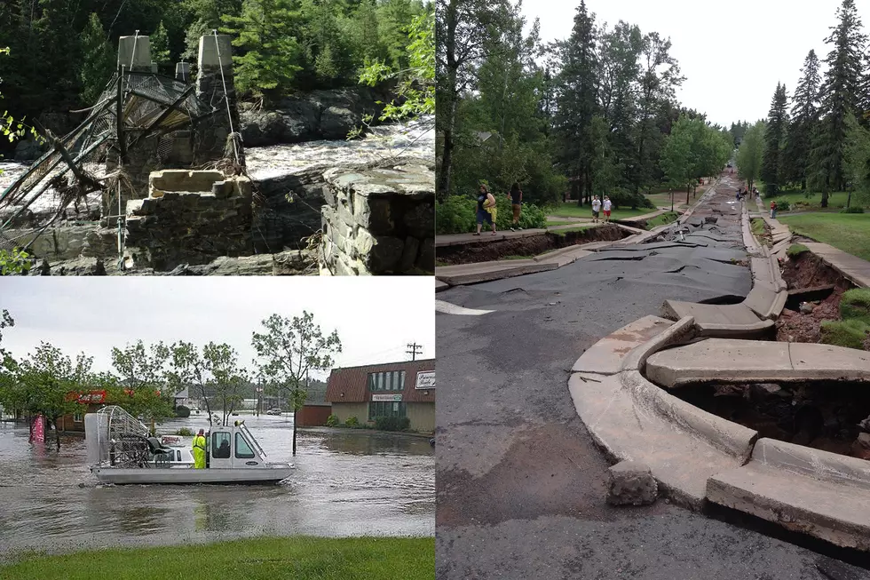
![See Photos of the Damage to Jay Cooke State Park and Learn When the Park will Re-Open [GALLERY]](http://townsquare.media/site/164/files/2012/07/DSC01614.jpg?w=980&q=75)
See Photos of the Damage to Jay Cooke State Park and Learn When the Park will Re-Open [GALLERY]
The Minnesota DNR offered a tour of the flood-ravaged Willard Munger State Trail and Jay Cooke State Park today (July 3) to media crews, offering damage estimates and a timeline on when they expect to have the park open for business.
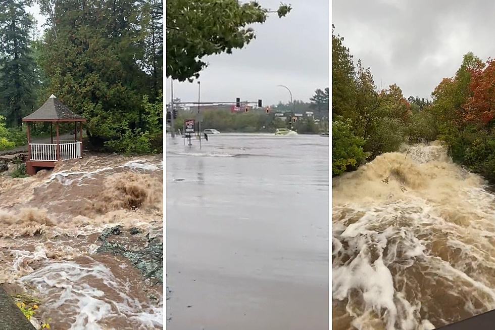
Roads and trails in many places in and around Jay Cooke State Park are in severe disrepair after the June 20 flooding, making travel around the park unsafe in many cases. Unsafe roads and trails paired with high water levels in the river not only pose a direct threat to would-be visitors, but would also make rescue efforts dangerous and difficult if necessary. These concerns led to the decision to close the park and cancel all camping reservations through the summer and into fall. Officials also urge everyone to stay out of the park due to these conditions. They advise not going around barricades and staying out of the park until further notice.
Jay Cooke is the 9th most visited state park of Minnesota's 75 state parks, bringing in over 300,000 visitors in 2010. Nearly 35,000 of those visitors stayed at least one night in the park. With all visitor traffic closed and camping reservations cancelled through October 31, 2012, it is expected the park will lose about $175,000 in camping and lodging revenue this season. Those with reservations are being refunded their money.
Coupled with the major loss of visitor revenue, the park is faced with expensive repairs that need to be made to infrastructure, including trails, sewer and water systems, and the suspension bridge. The bridge, which is one of the most popular attractions of the park, was severely damaged in the flooding. At the height of the flood, the bridge deck was under about 3 feet of water, and the access point from the visitor center was completely washed away from the shoreline. Being this bridge is a state historical landmark (built in the 1930s), repairing the structure is a complicated process. The DNR is investigating options on how they can repair the structure, and does not have an estimate on repair costs for any of the park damage at this time.
This is not the first time the suspension bridge has been damaged by flooding. Park officials explained that the bridge was consumed by the river in 1950. Repairs to the bridge in 1953, including raising the bridge deck four feet (the level at which it stood until this year's flood) to accommodate for flood conditions.
The Minnesota Department of Transportation was also on hand to address the extreme damage to MN Highway 210, which is the main artery through the park. While the roadway has several points at which it was damaged, there are two locations where the road was completely wiped away. One location, just west of the visitor center (where the suspension bridge stood), is now a hole 175 feet wide and 45 feet deep. The other location, just east of the visitor center, has a hole about 1,000 feet wide and 100 feet deep.
MNDOT is exploring options on how to efficiently re-establish travel through the park. Among options mentioned are installation of special bridge structures or new culvert systems. As options are explored, MNDOT has established a goal of making the road passable again by mid fall, which may allow for the park to be re-opened in some capacity.
Along with the extensive damage to Jay Cooke and the roadways within the park, several miles of the Willard Munger State Trail in the vicinity of Jay Cooke were damaged to the point of being unsafe for use. Bikers, inline-skaters, and walkers are being told to stay off the closed parts of the trail as conditions continue to degrade as more rain falls in the area. Engineers are working on repair solutions for the trail, which is an old railroad bed. Due to the nature of this trail, repairs will be time-consuming and expensive. It is estimated that trail repairs will cost $125,000 per mile of damaged trail.
Below is a gallery of photos from the Munger Trail, Jay Cooke Suspension Bridge, and Highway 210 in both washout locations.
More From MIX 108
