Updated Look At The 2023 Grandma’s Marathon Weekend Weather ForecastUpdated Look At The 2023 Grandma’s Marathon Weekend Weather ForecastSee the detailed and updated weather forecast for 2023 Grandma's Marathon Weekend.Nick CooperNick Cooper
Mystery ‘Poop’ Substance Rained Down In MinnesotaMystery ‘Poop’ Substance Rained Down In MinnesotaThe weather has been very strange in Minnesota this year. In one area, a mysterious 'poop' substance rained down briefly. IanIan
See Some Haze In The Sky Over Minnesota On Monday? Here's WhySee Some Haze In The Sky Over Minnesota On Monday? Here's WhyYou might notice a haze in the sky across the Northland today.Nick CooperNick Cooper
Minnesota Police Department Offers Heatstroke RemindersMinnesota Police Department Offers Heatstroke RemindersEven mildly warmer temps can lead to heatstroke for kiddos left in vehicles.Joe DangerJoe Danger
Duluth’s Michael’s Store Returns After Being Closed For More Than A MonthDuluth’s Michael’s Store Returns After Being Closed For More Than A MonthThe arts and crafts retailer was closed for over a month due to snow-related roof issues. Nick CooperNick Cooper
Yay? New Season Snowfall Record For Duluth Continues To GrowYay? New Season Snowfall Record For Duluth Continues To GrowAfter getting off to a fast start with a big December blizzard, it was just a matter of time before we broke the record. Nick CooperNick Cooper
What Are The 15 Snowiest Winters On Record In Duluth?What Are The 15 Snowiest Winters On Record In Duluth?The snowiest winters in Duluth's history include some impressive amounts. Here's how they rank.Nick CooperNick Cooper
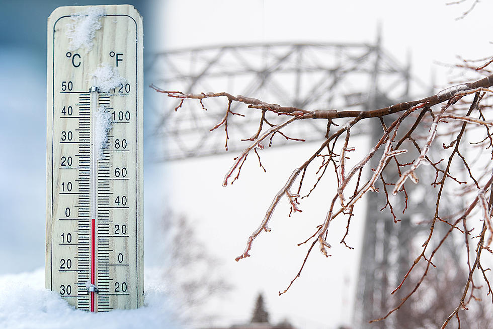
How Abnormal Are This Week’s Wintry Temperatures For Duluth?How Abnormal Are This Week’s Wintry Temperatures For Duluth?Winter-like temperatures and snow have returned after a few days of summer-like weather. How abnormal are these late-April chilly conditions?Nick CooperNick Cooper
Winter Isn’t Over Yet! Duluth Likely To Beat Snowiest Winter Ever Record This WeekWinter Isn’t Over Yet! Duluth Likely To Beat Snowiest Winter Ever Record This WeekHere's where things stand for this winter in the pursuit of the title of 'snowiest winter ever recorded in Duluth'.Nick CooperNick Cooper
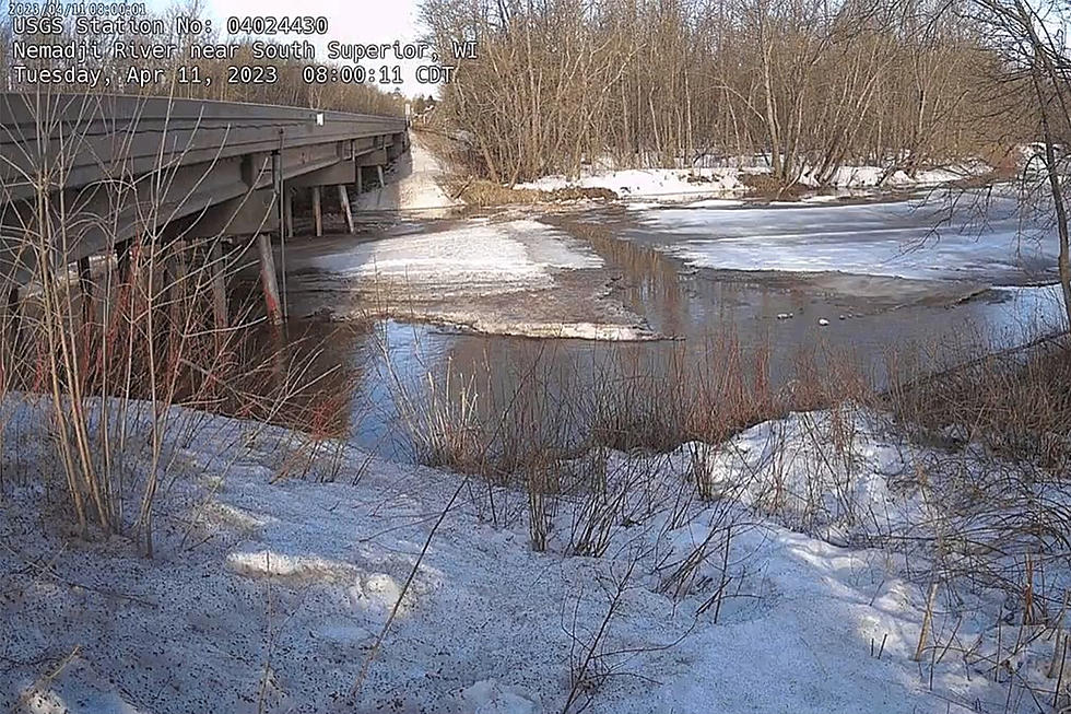
WATCH: Duluth NWS Shares Time-Lapse Of Nemadji River In Superior Quickly Swelling From Snow MeltWATCH: Duluth NWS Shares Time-Lapse Of Nemadji River In Superior Quickly Swelling From Snow MeltThings have changed a lot in just a couple of days!Nick CooperNick Cooper
Check Out All Of The Ice And Snow Stacked Up In Duluth’s Canal Park [PHOTOS]Check Out All Of The Ice And Snow Stacked Up In Duluth’s Canal Park [PHOTOS]Impressive waves left behind a sea of icy debris in Duluth's Canal Park and elsewhere along the Lake Superior shoreline. Nick CooperNick Cooper
Duluth Has Now Seen 3rd Snowiest Winter Ever RecordedDuluth Has Now Seen 3rd Snowiest Winter Ever RecordedDuluth's windy and messy storm pushed this winter even closer to a new record. Here's where things stand. Nick CooperNick Cooper


![Check Out All Of The Ice And Snow Stacked Up In Duluth’s Canal Park [PHOTOS]](http://townsquare.media/site/164/files/2023/04/attachment-dsc_5175.jpg?w=980&q=75)
