WATCH: MNDOT Video Shows How Quickly The Snow Is Falling In Northern Minnesota
While this winter has been generally snowless, a few "bigger storms" have reminded Minnesotans that it is indeed still winter. The most recent example of that is in Northwestern Minnesota, where the forecast is calling for up to nearly a foot of snow by the time things wrap up.
This strong, quick-moving storm is expected to bring between 6-11 inches of snow to a swath from parts of Northern Beltrami County up to Big Falls and International Falls, where the heaviest snow is expected to fall.
As this storm continues to do its thing, snow has quickly been piling up in the area forecasted to be hardest hit by one of the biggest storms of the season so far. While 6-11 inches of snow is by no means a "massive" snow event in our part of the world, it is one of the biggest we've seen during this abnormal winter.
READ MORE: Believe it or not, March is not Minnesota's snowiest month - this is what is
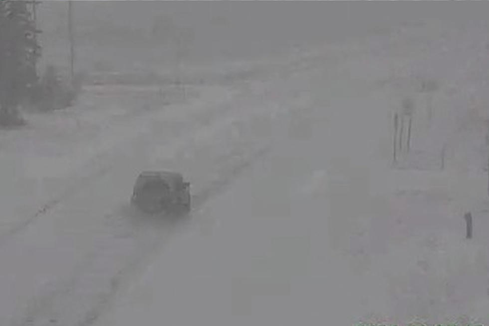
The Duluth National Weather Service has been watching as bands of heavier snow develop and lead to areas where conditions have been quickly deteriorating in the area. Snow, in some cases, could fall at a rate of 1-2 inches per hour during parts of Tuesday morning, which is a pretty fast clip that can make travel difficult and dramatically reduce visibility.
What does that fast snowfall look like?

The team with the Duluth office of the National Weather Service shared a quick video from a MNDOT camera near International Falls that illustrates just how rapidly road conditions can deteriorate and how quickly visibility can drop.
The timelapse shows conditions over a 2-hour span, with things really ramping up in the 8 am hour this morning.
While places elsewhere in Minnesota are not likely to see more than a dusting to maybe a couple of inches of snow, other effects from this storm will definitely be felt. As the system moves through, it will drag in cold air from up north that will give us air temperatures in the teens for daytime highs on Wednesday. Mix that with the windy conditions we're expecting, and wind chills could dip well below zero for Wednesday morning.
For those that are already over winter, the good news is a temperature rebound is in the forecast for the end of the week, with highs getting back to where they were on Monday by Friday.
Snowiest Cities & Towns In Minnesota
Gallery Credit: Nick Cooper
More From MIX 108