Updated Snowfall Totals In Northern Minnesota + Wisconsin From March 11-12 Storm
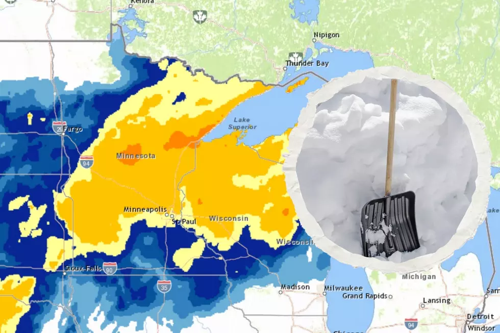
Heading into the weekend, the potential of up to 20 inches of snow was in the forecast from the National Weather Service for the latest winter storm to hit the Northland. As the weekend unfolded, those forecasts have largely held true, with over 20 inches having fallen in a couple of places throughout the weekend.
Snow wrapped up Sunday night into Monday morning across the region, with some hefty totals being reported and plenty of schools delcaring late starts or closings in response to the weekend's snow.
Adding to this week's fun,. the National Weather Service is also warning of an additional storm targeting the region for later this coming week. More on that in a bit.

In the meantime, here are the latest updated snowfall reports from around the region as of Monday morning at 11:30 am.
MORE: Winter 2022-2023 now among 10 snowiest winters on record for Duluth
Northern Minnesota & Wisconsin Snowfall Totals From March 11-12, 2023 Winter Storm
- Cornucopia, WI - 22 inches
- Billings Park Superior, WI - 20.6
- Washburn, WI - 18.5 inches
- Two Harbors, MN (4 miles WNW) - 18.5 inches
- Castle Danger, MN (6 miles WNW) - 18.2 inches
- Bayfield, WI - 16.5 inches
- Superior, WI - 14 inches
- Two Harbors, MN - 10.9 inches
- Palmers, MN - 17 inches
- Munger, MN - 16 inches
- Piedmont Duluth, MN - 16 inches
- Finland, MN - 16 inches
- Lester Park Duluth, MN - 15.9 inches
- Moquah, WI - 15.1 inches
- Arnold - Duluth, MN - 15 inches
- Maple, WI - 15
- Chester Park Duluth, MN - 15 inches
- Knife River MN - 15 inches
- Park Point Duluth, MN - 14.5 inches
- Silver Bay, MN - 14.5 inches
- Moose Lake, MN - 13.6 inches
- McGregor, MN - 13.5 inches
- McGrath, MN - 13.5 inches
- Red Cliff, WI - 13.5 inches
- Rice Lake, MN - 13.3 inches
- Holyoke, MN - 13.2 inches
- Kenwood Duluth, MN - 13 inches
- Kimberly, MN - 13 inches
- Sturgeon Lake, MN - 13 inches
- Grantsburg, WI - 12.6 inches
- Duluth NWS Office - 12.5 inches
- Finlayson, MN - 12.5 inches
- Hinckley, MN - 12.5 inches
- Aitkin, MN - 12.5 inches
- Hawthorne, WI - 12.5 inches
- Aitkin, MN - 12.5 inches
- Amnicon Falls State Park, WI - 12.2 inches
- Ashland, WI - 12 inches
- Solon Springs, WI - 12
- Gary New Duluth, MN - 12 inches
- Fond Du Lac, MN - 12 inches
- Wentworth, WI - 11.3 inches
- Tamarack, MN - 11 inches
- Cable, WI - 11 inches
- Kerrick, MN - 10.8 inches
- Brimson, MN - 10.6 inches
- Mahtowa, MN - 10.6 inches
- Oulu, WI - 10.5 inches
- South Range, WI - 10.5 inches
- Lincoln Park Duluth, MN 10.5 inches
- West Duluth, MN - 10 inches
- Foxboro, WI - 10 inches
- Floodwood, MN - 9.7 inches
- Sturgeon Lake, MN - 9.5 inches
- Wrenshall, MN - 9.5 inches
- Esko, MN - 9.3 inches
- Tofte, MN - 9 inches
- Iron Junction, MN - 9 inches
- Cloquet, MN - 8.8 inches
- Hermantown, MN - 8.7 inches
- Wright, MN - 8.4 inches
- Minong, WI - 8 inches
- Trego, WI - 8 inches
- Grand Rapids, MN - 8 inches
- Silver Bay, MN - 7.5 inches
- Hibbing, MN - 7 inches
As mentioned, there is another round of snow on the way for later this week. The National Weather Service says the strongest impacts of this storm will be Thursday night, into Friday. Adding to the challenge of forecasting snow totals is that rain and mixed precipitation are likely to be what will be falling as this system moves in, changing to snow Thursday afternoon. Some heavier snow is possible, but a lot is likely to change in the forecast details between now and the storm's arrival later this coming week.
6 Vital Reminders Every Minnesotan Should Know If You Have To Drive During A Snowstorm
More From MIX 108


