![‘Powerful’ Winter Storm Prompts Winter Storm Watch For Region [UPDATED]](http://townsquare.media/site/164/files/2014/10/Duluth-Snow-Road-Sign-630x420.jpg?w=630&h=420&zc=1&s=0&a=t&q=89&w=980&q=75)
‘Powerful’ Winter Storm Prompts Winter Storm Watch For Region [UPDATED]
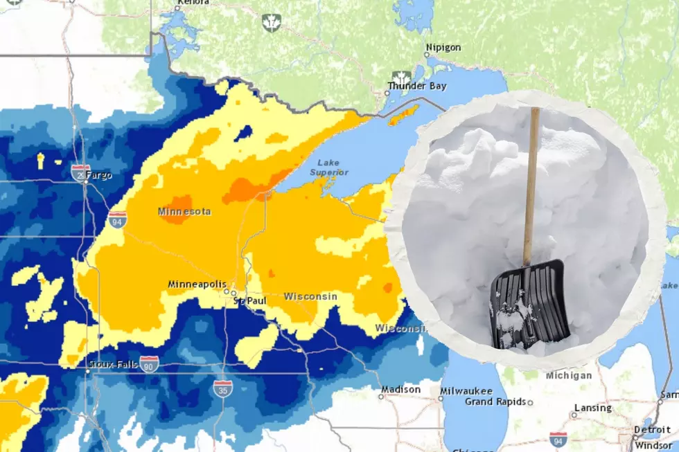
The National Weather Service is tracking what they're calling a "powerful early spring storm" targeting the region this week. This storm has prompted a winter storm watch starting Wednesday morning and running through Thursday evening for the Twin Ports, North Shore, and South Shore.
Rain will be the first part of this storm, changing to snow late Tuesday mainly in the northern parts of the warned area. Wednesday morning a rain-snow mix is possible, changing to snow through the entire warned area. Heavy snow is possible at times falling at a rate of an inch an hour in the earlier parts of Wednesday, and could impact the morning commute. Snow will taper off late Wednesday, however lake effect snowfall may persist through Thursday morning.
Snow Predictions
The warning is calling for 6-10 inches of snow through much of the warned area, but those amounts could change depending on when temperatures cold enough for snow push into any given part of the area. Higher elevations could see amounts greater than 10 inches.
Travel Precautions
Snowfall will be heavy at times, and there is a likelihood of fog accompanying this storm, which could drop visibility to less than a quarter of a mile at times. Beside visibility concerns, the heavy snow on the roadways could also impact driving conditions. The heaviest snowfall is expected Wednesday morning, and could impact the morning commute.
More From MIX 108