VIDEOS: First Ever February Tornado Rips Through Wisconsin
Just a day ago, the Storm Prediction Center had issued an outlook that included a chance of "general" (non-severe thunderstorms in Minnesota and Wisconsin. Later-day forecasts from the SPC on Wednesday saw that storm potential shift out of most of Minnesota, but remaining in Wisconsin.
While most of Wisconsin was not expected to see severe storms, the possibility of southern parts of the state seeing stronger storms did pop up in the SPC's outlook for today.
Not only did that possibility of stronger storms come to fruition, but it also led to a tornado being spawned - the first-ever tornado recorded in February in Wisconsin.
Thunderstorms blossomed in Southeastern Wisconsin on Thursday evening, prompting a handful of severe thunderstorm warnings and even a tornado warning in an area between Janesville and Milwaukee and northward toward Watertown.
Thunderstorms alone are very abnormal for places like Wisconsin in February, but an outbreak of severe weather is even more abnormal for this time of year in the Badger State.

The storms generated hail in places like Bayside, just north of Milwaukee. Mike De Sisti shared a video of what looks like pea to marble-size hail falling during this February storm.
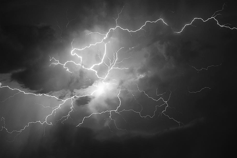
Mike also shared a video of the lighting show that these storms generated just north of Milwaukee.
Holly Swaney also caught a very interesting phenomenon in a series of photos just southeast of Mauston, WI. The La Crosse National Weather Service office says the photos appear to show what they describe as "a rain shaft from the thunderstorm".
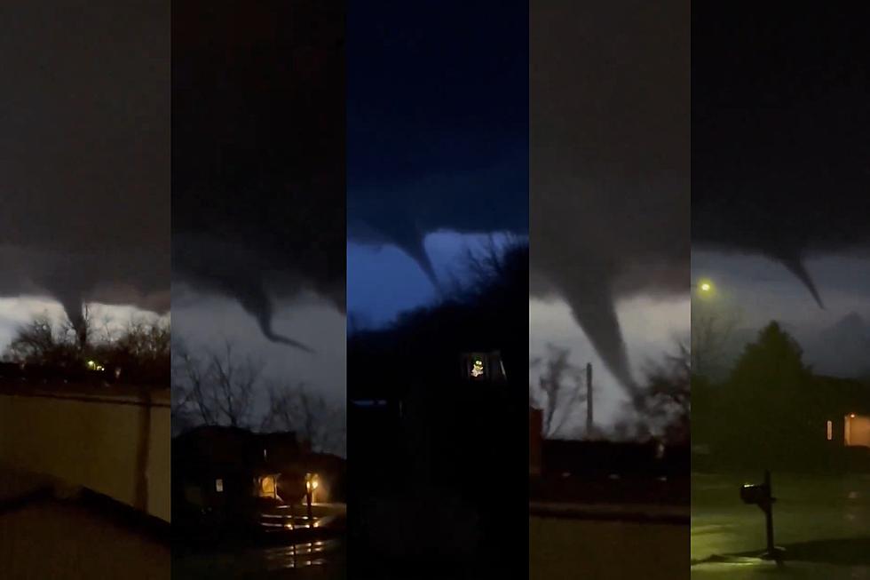
The wildest visuals are that a tornado, the first ever recorded in Wisconsin in February.
Tom Purdy captured and shared video of a funnel cloud near Albany, Wisconsin.
A video captured by Kathy Thomas in Evansville, Wisconsin and shared by Sam Kraemer of FOX 6 TV in Milwaukee, shows the tornado sizable tornado extending near the ground.
Another video shared by Kraemer from Evansville was captured by Alyssa Grover, showing the tornado lifting toward the clouds before trying to re-establish.
Reports of lots of damage are coming from the area near the Evansville tornado. Gazette Extra is reporting the tornado was confirmed by the National Weather Service that touched down around 6 pm on Thursday evening, following a path between Albany and Evansville.
Downed power lines, buildings with their roofs blown off, downed trees, and other damage were noted in early reports. Emergency workers told a reporter from the Gazette it could take days to clear downed trees and damage left behind by the storm.
Here are a couple of photos captured in Rock County, WI showing some of the damage from the storms.
Biggest snowfalls recorded in Wisconsin history
Gallery Credit: Stacker
More From MIX 108