Minnesota Weather Radar Captures ‘Interesting Phenomenon’ Monday Morning
Once in awhile, weather radar or satellite capture things other than the the run of the mill rain/snow and clouds. Sometimes funny, sometimes gross, and sometimes just plain 'interesting' things are caught on radar and satellite images.
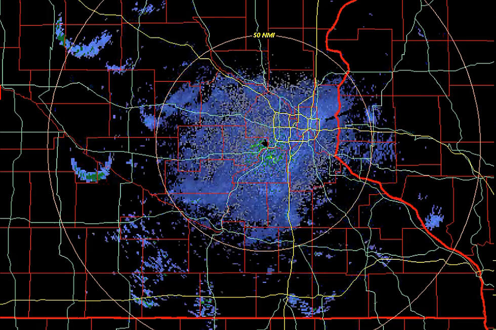
One of those 'interesting' things was caught on Monday morning on the Twin Cities area weather radar. If you watch the radar loop below, you'll see what might look like some light rain showers (light blue color) around much of central and southern Minnesota, including a series of expanding circles all over the place. Also seen are what looks like some small thundershowers (greens, yellows, oranges) in southern Minnesota and Iowa. The thing is, there wasn't any rain in sight.
As the Twin Cities office of the National Weather Service explained on Twitter, those expanding circles that happened right around the time of sunrise were actually flocks of birds taking off from lakes. As for the brighter "storm colors", they explain that those are radar reflections off turbines from wind farms.
The Twin Cities NWS office went on to explain in a second tweet "Under the right atmospheric conditions, such as the temperature inversion this morning, the radar beam is refracted and bends toward the ground and can reflect off the blades. Our radar algorithm can remove stationary ground clutter, but moving objects like wind turbines show up."
More From MIX 108


![What Is This? Strange Object Spotted In The Sky Over Minnesota [VIDEO]](http://townsquare.media/site/164/files/2024/04/attachment-MNObject1-Feature.jpg?w=980&q=75)